Buran Ghati Trek
From
Duration
Tour Type
Overview
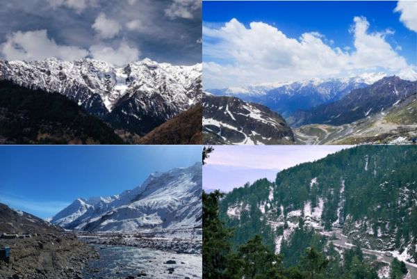
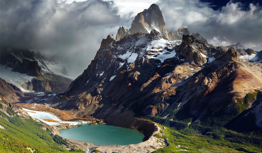
The Buran Ghati Trek offers a captivating journey through landscapes and breath taking vistas. Here’s an overview with key points:
- Starting Point: The trek typically begins from picturesque farms, setting the stage for a scenic adventure .
- Trail Through Pine Forests: After about an hour, the route leads into stunning pine forests, offering an enchanting experience with beautiful clearings along the way.
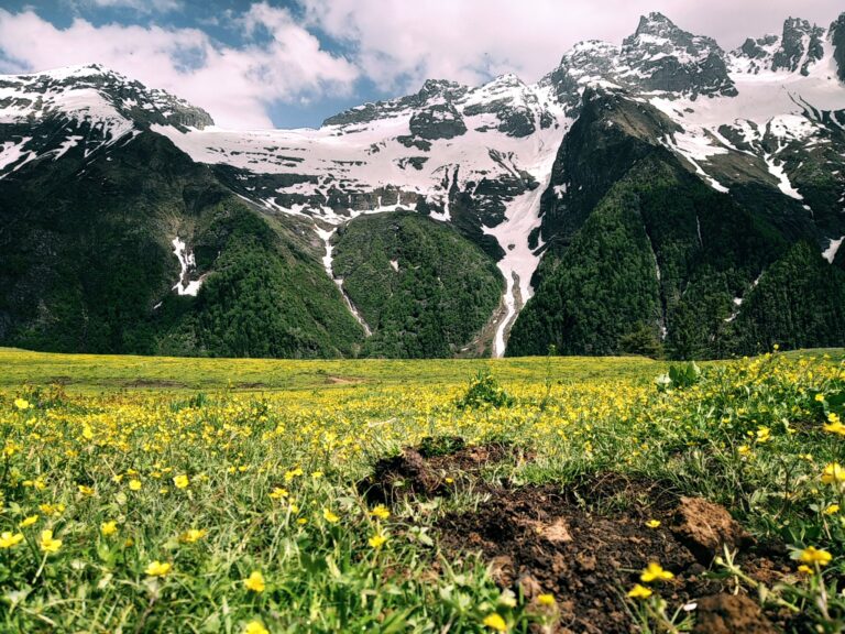
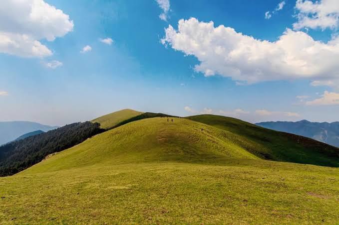
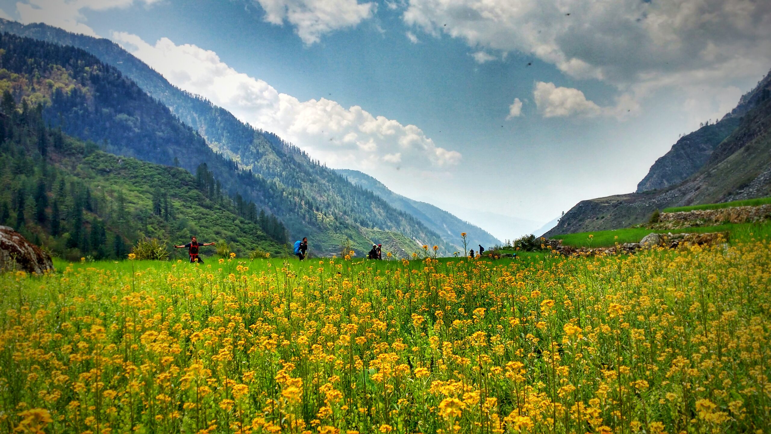
- Vast Grasslands: The trail then opens up into vast grasslands, providing panoramic views and a sense of vastness amidst nature’s beauty.
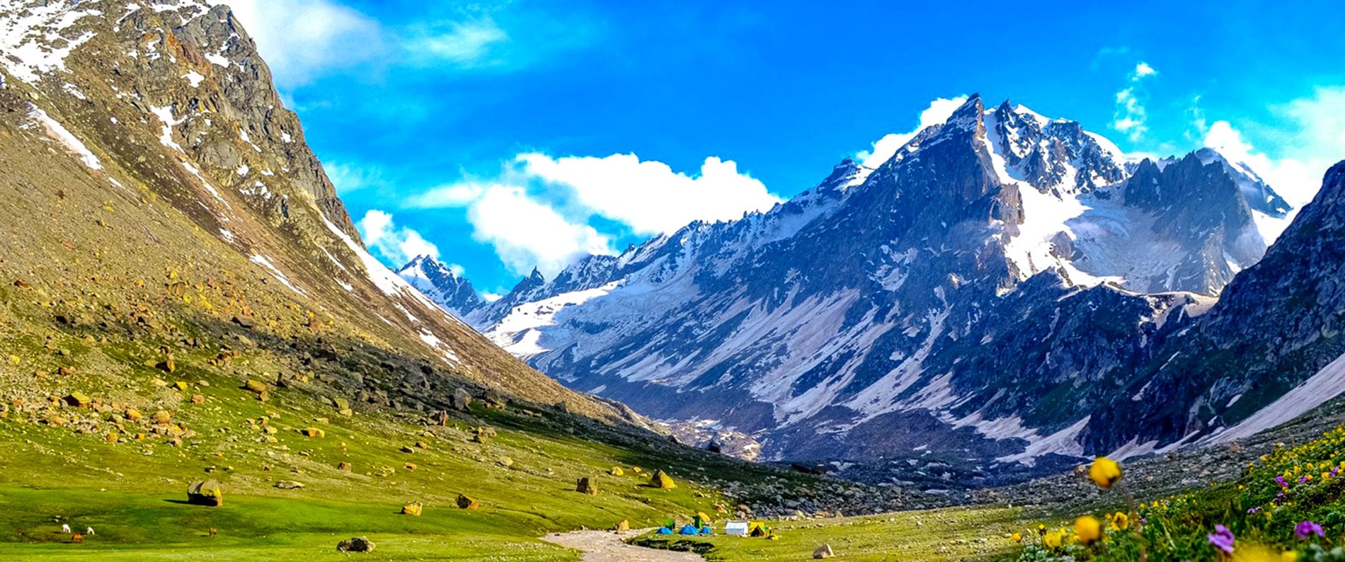
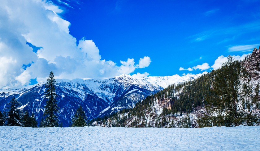
- Dayara Meadows: One of the highlights of the trek is reaching the stunning Dayara Meadows, which are incredibly scenic and reminiscent of postcard-perfect landscapes.
- ‘Wow’ Point: Trekkers encounter the ‘wow’ point, where the first view of Dayara unfolds, leaving them in awe of the sheer beauty of the surroundings.
- Overall Experience: The trek offers a perfect blend of diverse landscapes, from forests to meadows, providing trekkers with an unforgettable experience amidst nature’s splendor.
- Difficulty Level: Considered moderate in difficulty, the trek offers challenges along with ample opportunities to soak in the beauty of the Himalayan terrain.
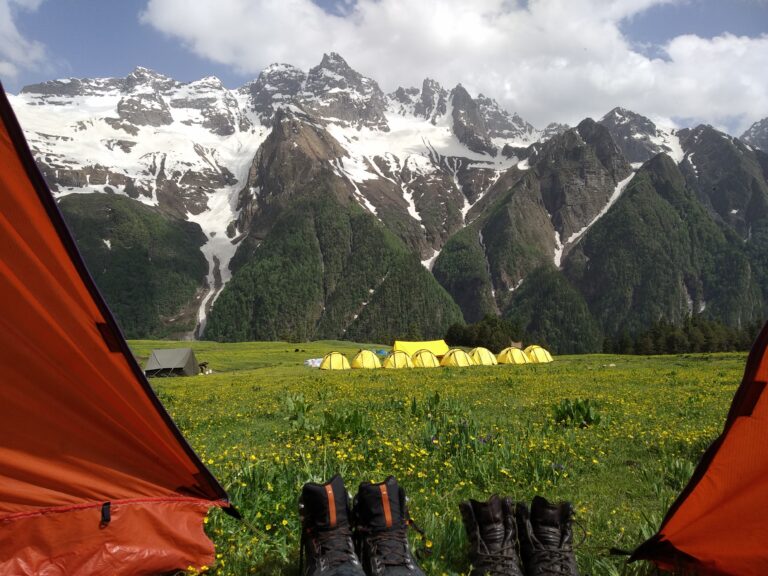
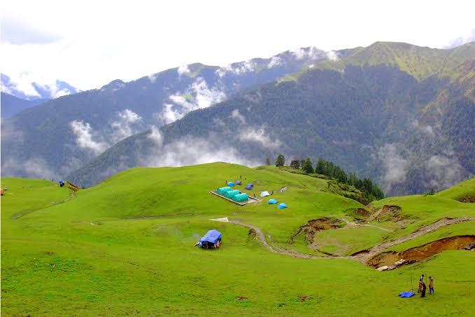
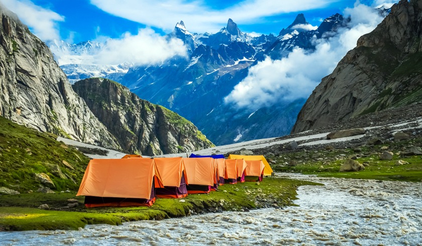
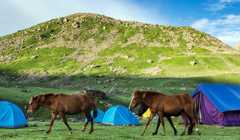
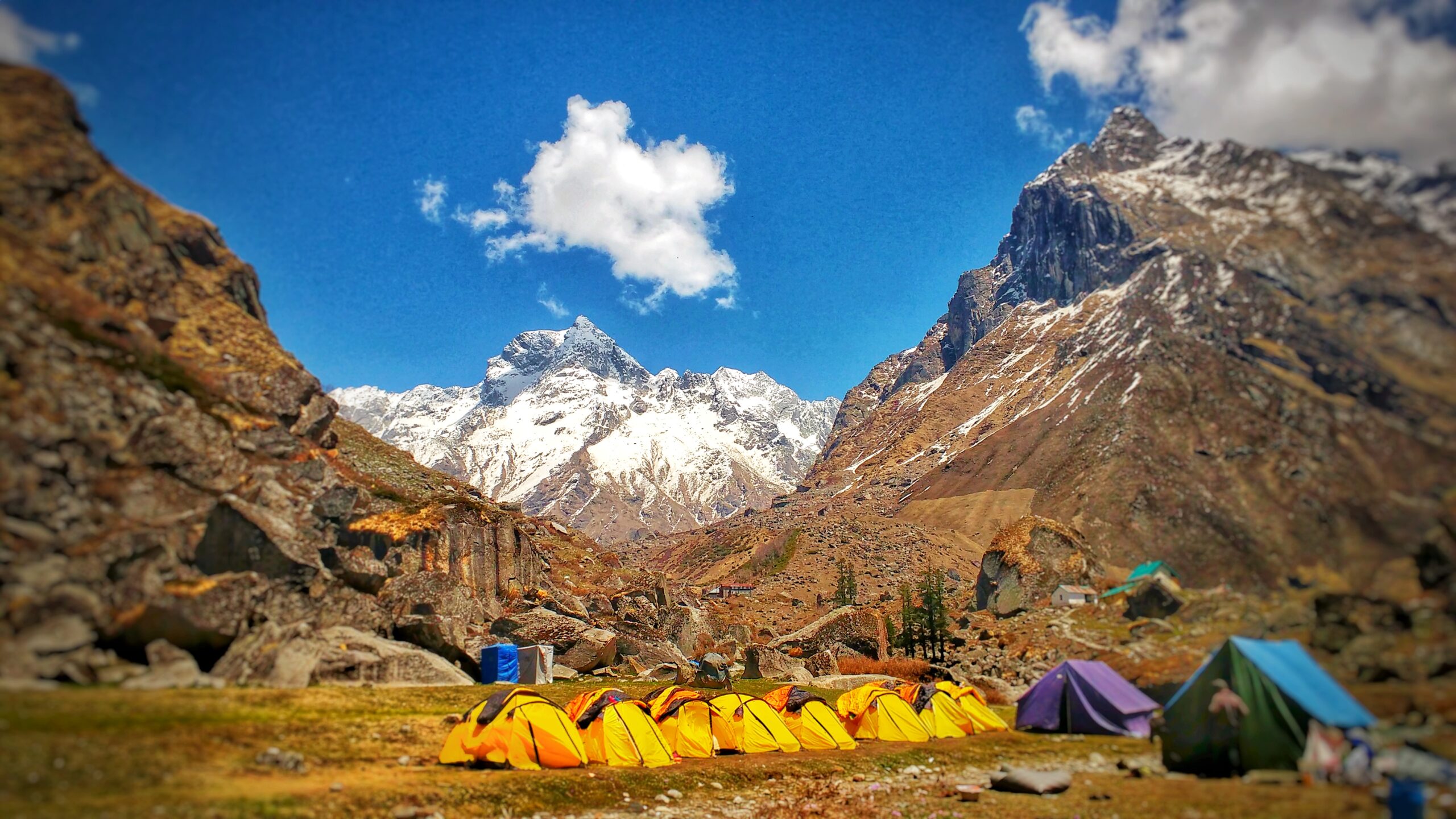
- Campsites: Several beautiful campsites along the route offer tranquil settings for trekkers to rest and rejuvenate amidst nature.
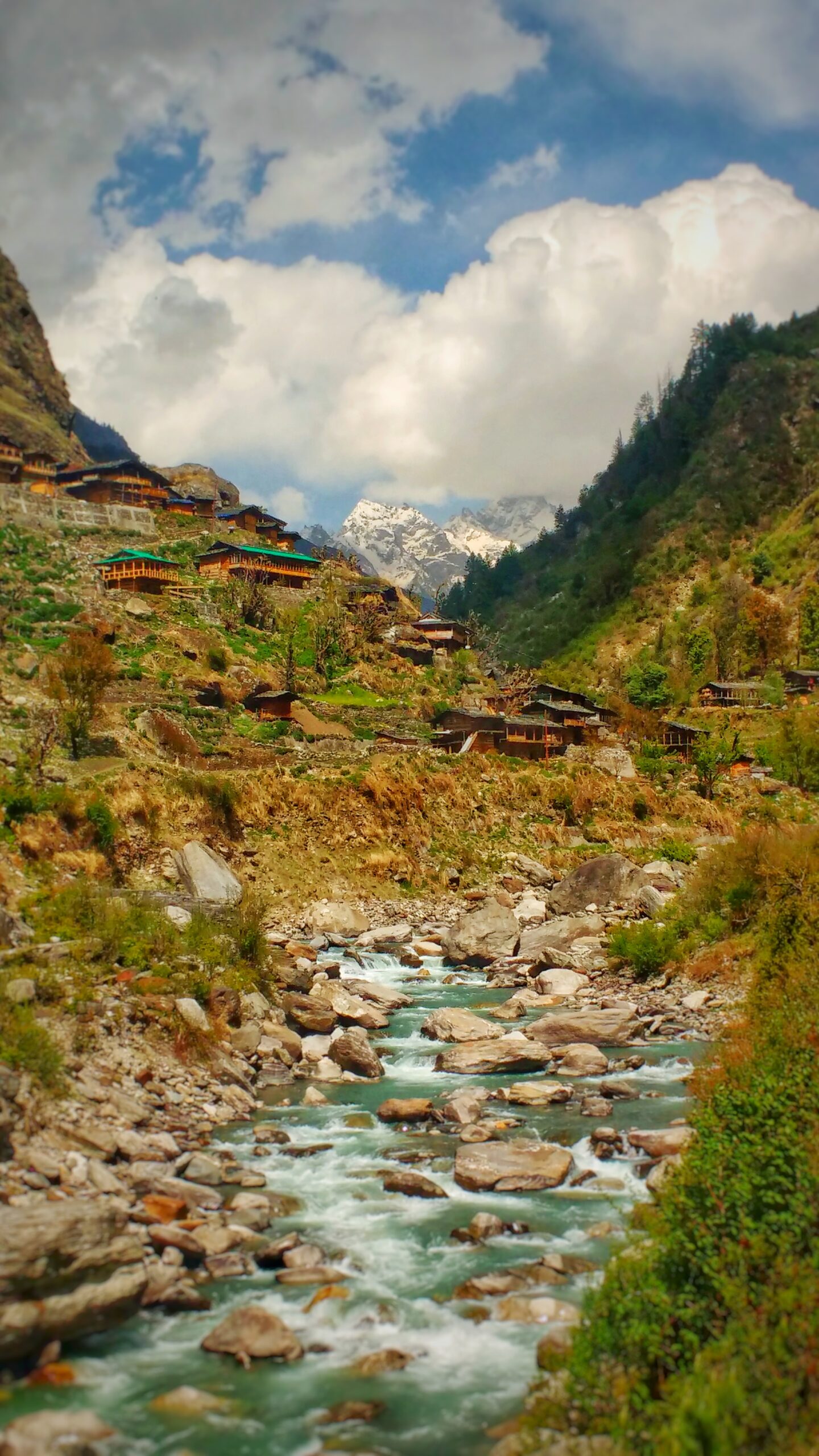
- Local Culture: Interactions with locals along the way offer insights into the rich culture and way of life in the Himalayan villages.
- Conclusion: The Buran Ghati Trek promises an exhilarating journey filled with natural beauty, adventure, and cultural experiences, making it a must-visit destination for trekking enthusiasts.
Included / Exclude
- Buran Ghati is a picturesque mountain pass located in the Indian state of Himachal Pradesh. Here is some included content about Buran Ghati:
- Altitude: The Buran Ghati pass sits at an altitude of approximately 15,000 feet above sea level, offering breathtaking views of the surrounding Himalayan peaks.
- Trek Distance: The trek to Buran Ghati covers a distance of around 50-60 kilometers, depending on the specific route chosen. It typically takes around 7-8 days to complete the trek, including acclimatization days and rest stops.
- Difficulty: The Buran Ghati trek is considered a moderately difficult trek suitable for experienced trekkers. The terrain includes steep ascents, rocky paths, and challenging river crossings, requiring physical fitness and proper acclimatization.
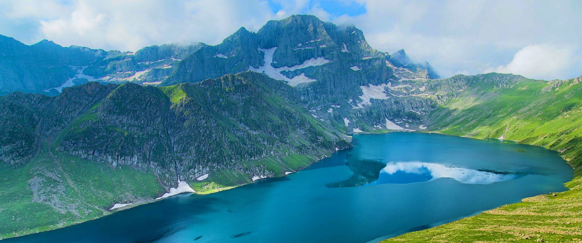
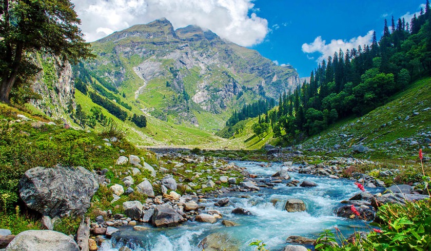
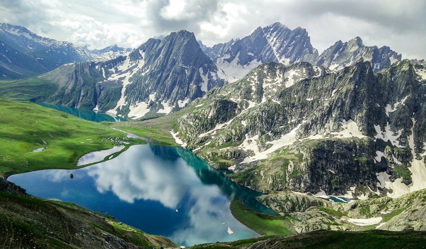
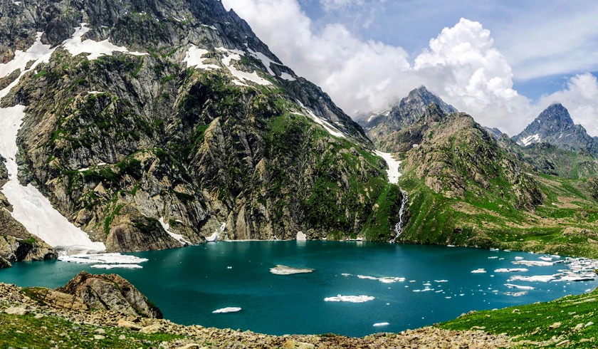
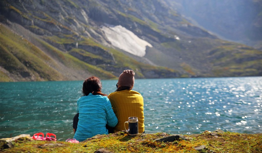
- Highlights: Along the trekking route, trekkers encounter a variety of stunning landscapes, including lush green meadows, dense forests, and pristine alpine lakes. The highlight of the trek is crossing the Buran Ghati pass itself, which offers panoramic views of snow-capped peaks and glaciers.
- Campsites: There are several picturesque campsites along the Buran Ghati trek route, including Dayara Bugyal, Litham, Dhunda, and River Camp. These campsites provide opportunities for trekkers to rest, enjoy meals, and soak in the natural beauty of the Himalayas.
- Wildlife: The region surrounding Buran Ghati is home to a diverse range of flora and fauna, including Himalayan blue sheep, musk deer, and various species of birds. Trekkers may have the chance to spot these animals during their journey.
- Weather: The weather in the Buran Ghati region can be unpredictable, with temperatures ranging from cold to freezing depending on the season. Trekkers should be prepared for sudden changes in weather conditions and carry appropriate clothing and gear.
- Overall, the Buran Ghati trek offers an unforgettable adventure through some of the most stunning landscapes in the Indian Himalayas, making it a popular choice for outdoor enthusiasts and nature lovers.
- Excluded content regarding Buran Ghati might involve more detailed discussions on:
- Technical aspects of the trek: This could include specific information about technical gear required for the trek, such as ropes, harnesses, and crampons, as well as detailed descriptions of any technical climbing sections along the route.
- Weather conditions: While included content may provide an overview of weather considerations, excluded content might delve into more specific details about seasonal variations, potential weather hazards, and strategies for dealing with extreme weather events.
- Environmental conservation: Excluded content could explore initiatives or challenges related to environmental conservation in the Buran Ghati region, including discussions on sustainable trekking practices, biodiversity conservation efforts, and community-led conservation initiatives.
- Cultural and historical context: While included content may touch upon the cultural and historical significance of the region, excluded content might provide more in-depth discussions on the indigenous cultures, traditions, and historical landmarks associated with the area surrounding Buran Ghati.
- Personal anecdotes and experiences: Excluded content may include firsthand accounts and personal narratives from trekkers who have undertaken the Buran Ghati trek, offering insights into their experiences, challenges faced, and memorable moments along the journey.
- Overall, excluded content may provide a deeper understanding of the trekking experience, environmental considerations, cultural context, and personal perspectives related to Buran Ghati.
Tour Itinerary
- Altitude: 2,800 m or 9,200 ft
- Distance: 160 km & Time:- 9-11 hours by drive
- Pick-up from/at: Shimla Old Bus Stand/06:30 AM
- Shimla to Rohru: 115 Km
The journey from Shimla to Rohru covers a distance of approximately 115 kilometers and typically takes around 9 to 11 hours by road, depending on the road conditions and traffic. The starting point for this journey is the Shimla Old Bus Stand, where the pick-up is scheduled for 6:30 AM.
As you depart from Shimla, you'll embark on a scenic drive through the picturesque landscapes of Himachal Pradesh. The route offers stunning views of lush green valleys, dense forests, and snow-capped mountains, creating a truly mesmerizing experience for travelers.
Along the way, you'll pass through charming villages, where you can catch glimpses of the local way of life and architecture. The road winds its way through the Himalayan terrain, with several bends and curves offering panoramic vistas at every turn.
One of the highlights of the journey is crossing the Sutlej River, which adds to the scenic beauty of the surroundings. As you continue your drive towards Rohru, you'll gradually ascend to higher altitudes, passing through remote areas and pristine natural landscapes.
Upon reaching Rohru, you'll be greeted by the tranquil atmosphere of this small town, nestled amidst the mountains. Known for its apple orchards and serene surroundings, Rohru offers a peaceful retreat away from the hustle and bustle of city life.
Overall, the journey from Shimla to Rohru is not just a means of transportation but also an opportunity to immerse yourself in the breathtaking beauty of the Himalayas and soak in the tranquility of the Himachali countryside.
- Altitude: 3,400 m or 11,150 ft
- Trek Distance/Time: 4 km/5-6 hours
- Water Sources: available on the way
- Shepherd's huts on the way
- Various pine, Oak, deodar forests and meadows will be covered
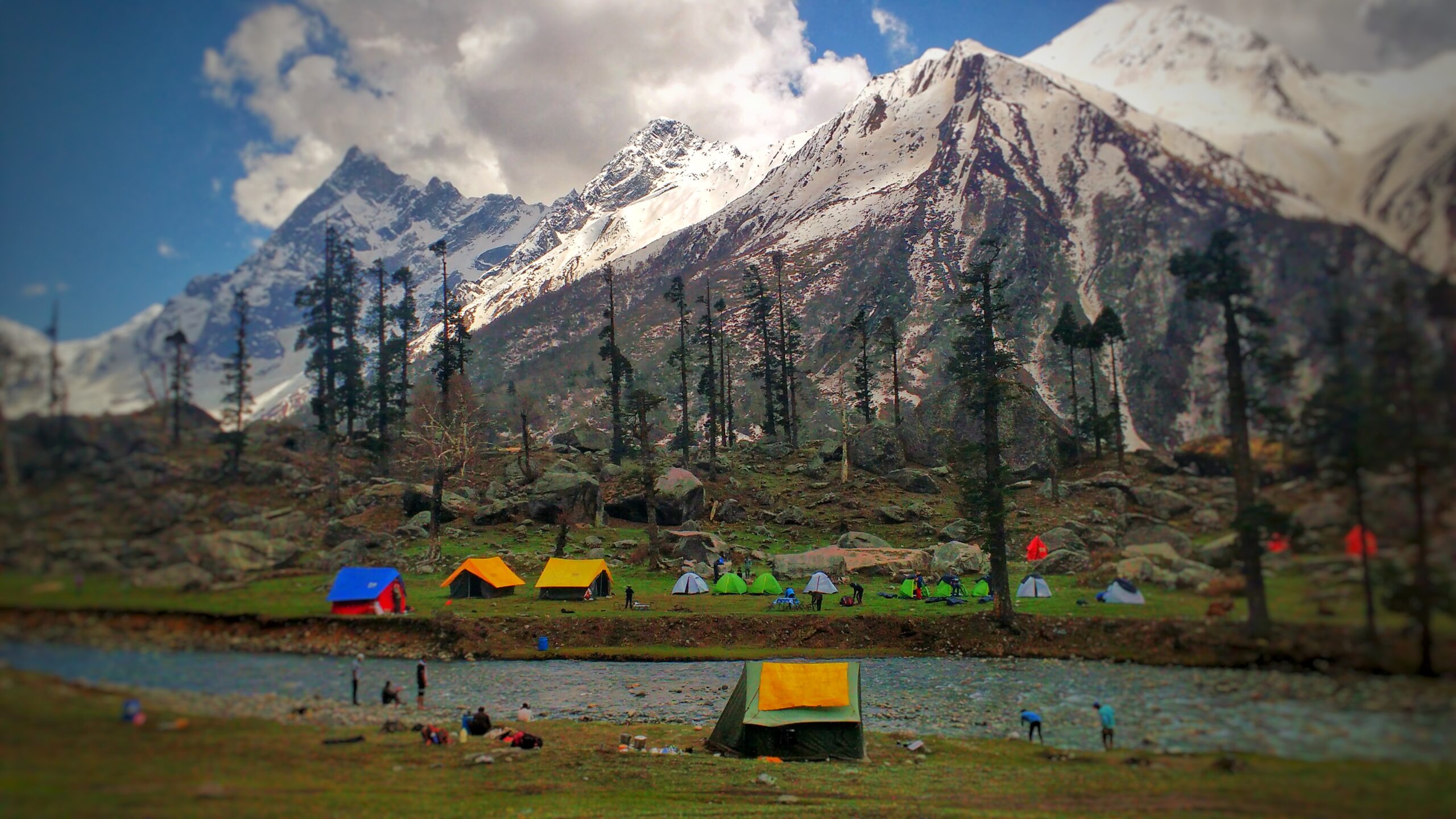
- Night Stay: Tent(Sharing-2)
At an altitude of 3,400 meters or 11,150 feet, this trek covers a distance of approximately 4 kilometers, typically taking around 5 to 6 hours to complete. Along the way, trekkers will encounter various landscapes, including dense pine, oak, and deodar forests, as well as expansive meadows.
One of the highlights of this trek is the availability of water sources along the route, ensuring that trekkers can stay hydrated throughout their journey. Additionally, shepherd's huts dot the trail, providing opportunities for rest and shelter if needed.
Upon reaching the designated campsite, trekkers will stay overnight in tents, with each tent typically accommodating two individuals on a sharing basis. The campsite offers a serene and immersive experience, allowing trekkers to connect with nature and enjoy the tranquility of the mountains.
As night falls, the campsite transforms into a peaceful retreat, with the starry sky overhead and the sounds of nature all around. It's a perfect opportunity to unwind after a day of trekking, sharing stories with fellow trekkers around the campfire, and soaking in the beauty of the Himalayan wilderness.
Overall, the trek promises an unforgettable adventure amidst stunning natural landscapes, offering a unique opportunity to explore remote mountain trails and create lasting memories in the great outdoors.
- Altitude: 3,600 m or 11,800 ft
- Trek Distance/Time: 3 km/3-4 hours
- Water Sources: available on the way
- Move through Silver Birch forest and Chandranahan waterfall
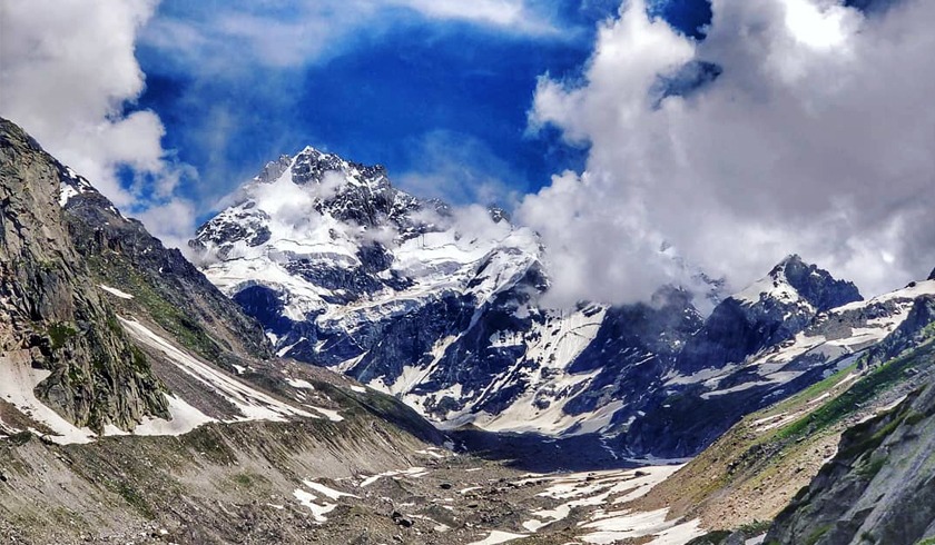
- Dhauladhar range with snow-covered mountains
- Hot lunch
At an altitude of 3,600 meters or 11,800 feet, this trek covers a distance of approximately 3 kilometers, typically taking around 3 to 4 hours to complete. The route offers access to water sources along the way, ensuring trekkers can stay hydrated throughout their journey.
One of the highlights of this trek is the opportunity to traverse through a Silver Birch forest, known for its stunning natural beauty and tranquil ambiance. As trekkers make their way through the forest, they'll be greeted by the soothing sounds of nature and the enchanting sight of sunlight filtering through the trees.
Another noteworthy feature of the trek is the majestic Chandranahan waterfall, which adds to the scenic allure of the route. Trekkers can pause to admire the cascading waters and capture memorable photographs amidst the pristine wilderness.
Throughout the trek, participants will be treated to breathtaking views of the Dhauladhar range, with snow-covered mountains dominating the horizon. These awe-inspiring vistas serve as a reminder of the raw, untouched beauty of the Himalayas.
At the designated lunch stop, trekkers can enjoy a hot and hearty meal, replenishing their energy reserves for the remainder of the journey. It's a perfect opportunity to refuel, relax, and soak in the natural splendor of the surroundings before continuing on with the trek.
Overall, this trek offers an unforgettable adventure amidst some of nature's most spectacular landscapes, providing trekkers with an immersive experience in the heart of the Himalayas.
v
- Altitude: 4,200 m or 13,800 ft
- Trek Distance/Time: 3 km (Single way)/6-7 hours
- Begin: Early morning
- Water Sources: available on the way
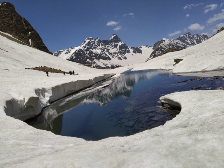
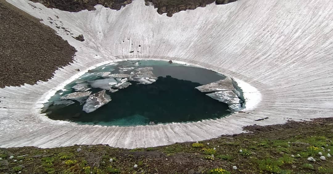
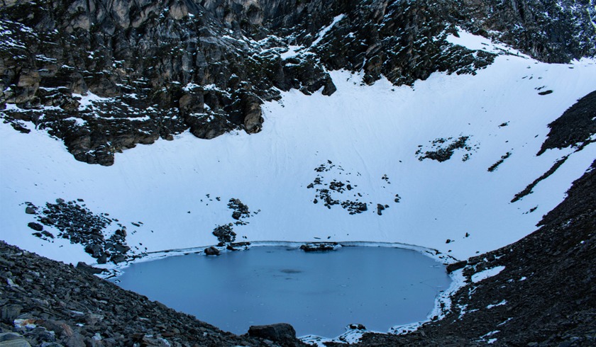
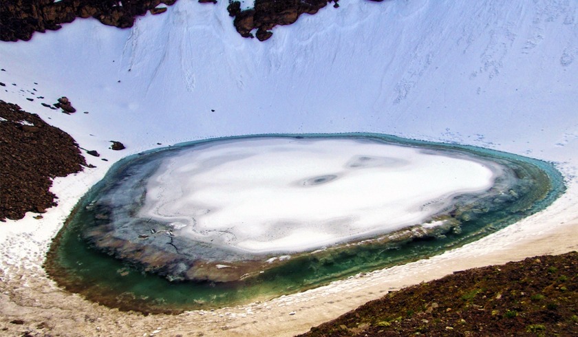
- Chandranahan forms a group of 7 lakes
- 3 lakes can be seen
- Hot lunch
At an altitude of 4,200 meters or 13,800 feet, this trek spans approximately 3 kilometers in a single direction, typically requiring 6 to 7 hours to complete. It's advisable to begin early in the morning to make the most of the day and ensure ample time to explore the stunning landscapes along the way.
One of the most captivating features of this trek is the Chandranahan, a group of seven picturesque lakes nestled amidst the Himalayan wilderness. While the entire group consists of seven lakes, trekkers usually have the opportunity to witness the beauty of three of these pristine lakes during their journey.
As trekkers traverse the rugged terrain, they'll encounter water sources along the way, providing opportunities to refill water bottles and stay hydrated throughout the trek. This ensures that participants can enjoy the adventure without worrying about running out of water during their ascent.
The trek offers breathtaking views of the surrounding mountains and valleys, with the rugged terrain and towering peaks creating a dramatic backdrop against the azure skies. Trekkers can immerse themselves in the natural beauty of the Himalayas, with every step offering new vistas to explore and admire.
After a challenging yet rewarding trek, participants can look forward to a hot and satisfying lunch, providing a much-needed energy boost and a chance to rest and rejuvenate amidst the pristine wilderness. It's a perfect opportunity to reflect on the day's adventures and savor the sense of accomplishment that comes with conquering new heights in the majestic Himalayas.
Overall, this trek offers an unforgettable journey through some of nature's most breathtaking landscapes, providing trekkers with an immersive experience in the heart of the Himalayas and the chance to discover the hidden treasures of Chandranahan.
- Altitude: 4,000 m or 3,100 ft
- Trek Distance/Time: 4 km/5-6 hours
- Water Sources: available on the way
- Hot lunch
At an altitude of 4,000 meters or 13,100 feet, this trek covers a distance of approximately 4 kilometers and typically takes around 5 to 6 hours to complete. As trekkers traverse the rugged terrain, they'll encounter various water sources along the way, ensuring they can stay hydrated throughout their journey.
After a challenging yet rewarding trek, participants can look forward to a hot and satisfying lunch. This meal serves as a well-deserved reward for their efforts, providing essential nourishment and energy to replenish their strength after a day of trekking through the scenic landscapes of the Himalayas.
The hot lunch offers a chance for trekkers to refuel their bodies and recharge their spirits, fostering a sense of camaraderie as they gather together to enjoy a delicious meal amidst the natural beauty of their surroundings. It's a moment to relax, unwind, and reflect on the day's adventures while savoring the flavors of hearty Himalayan cuisine.
Overall, the hot lunch serves as a comforting and rejuvenating break, allowing trekkers to pause and appreciate the wonders of nature while indulging in a satisfying meal that nourishes both body and soul.
- Altitude: 3,600 m or 11,800 ft via 4,550 m or 15,000 ft
- Trek Distance/Time: 7 km/10-11 hours
- Do carry water bottles with you
- Do follow your guide's instructions
- Riverside camping
- Packed lunchAt an altitude ranging from 3,600 meters to 4,550 meters (11,800 feet to 15,000 feet), this trek covers a distance of approximately 7 kilometers and typically takes around 10 to 11 hours to complete. It's essential for trekkers to carry their water bottles to stay hydrated throughout the challenging ascent.Following the guide's instructions is crucial for safety and navigation, especially in high-altitude environments where the terrain can be unpredictable. The trek offers a unique opportunity for riverside camping, allowing participants to immerse themselves in the tranquility of nature while enjoying the soothing sounds of flowing water.For sustenance during the trek, a packed lunch is provided, offering a convenient and nourishing option for refueling along the way. This meal is carefully prepared to provide trekkers with the energy they need to tackle the demanding terrain and reach their destination comfortably.Overall, the combination of stunning mountain vistas, riverside camping, and a hearty packed lunch makes for an unforgettable trekking experience in the breathtaking landscapes of the Himalayas. Trekkers can enjoy the beauty of nature while embarking on an exhilarating adventure that challenges both body and spirit.
- Altitude: 2,000 m or 6,600 ft
- Trek Distance/Time: 5 km/4-5 hours
- Do carry water bottles with you
- Forests to be crossed
- Reach Barua village by- 12:00 PM
- Lunch: Barua village
- Leave for Shimla: 01:00 PM
- Reach Shimla: between 10:00 PM to 11:00 PM
At an altitude of 2,000 meters (6,600 feet), this trek covers a distance of approximately 5 kilometers and takes around 4 to 5 hours to complete. It's important for trekkers to carry their water bottles to stay hydrated throughout the journey, especially when crossing forests along the way.
Upon reaching Barua village by noon, trekkers can enjoy a hearty lunch to refuel and recharge for the remainder of the day's activities. After lunch, the group will depart for Shimla around 1:00 PM, aiming to reach the destination between 10:00 PM to 11:00 PM, concluding the trek on a satisfying note.
- What is the Buran Ghati Trek?
- The Buran Ghati Trek is a popular trekking route in the Indian state of Himachal Pradesh, known for its scenic beauty, alpine meadows, and thrilling experiences such as crossing the Buran Ghati Pass. The trek takes adventurers through remote villages, dense forests, and high-altitude landscapes.
- How long is the Buran Ghati Trek?
- The Buran Ghati Trek typically spans around 6 to 8 days, depending on the specific itinerary chosen by trekkers. This duration includes trekking days, acclimatization days, and rest days.
- What is the difficulty level of the Buran Ghati Trek?
- The Buran Ghati Trek is considered moderately challenging. It involves steep ascents, descents, and traversing rugged terrain, including snow patches near the pass. Trekkers should have prior trekking experience and a reasonable level of fitness to undertake this adventure.
- When is the best time to do the Buran Ghati Trek?
- The best time to undertake the Buran Ghati Trek is during the summer months of June to September. During this period, the weather is relatively stable, and the snow has melted, making it easier to cross the Buran Ghati Pass.
- What is the altitude of the Buran Ghati Pass?
- The Buran Ghati Pass is situated at an altitude of approximately 4,570 meters (14,993 feet) above sea level. Trekkers need to acclimatize properly and be prepared for altitude-related challenges during the ascent to the pass.
Calendar & Price
Buran Ghati
Buran Ghati
Buran Ghati
Buran Ghati
Buran Ghati
Buran Ghati
Related Tours
Review Scores
Customer Care : +91-7055613666
Tour Information
Max Guests
Min Age
Tour Location
Languages Support
Booking Tour
Last Minute Deals
- Quality4.6
- Location5
- Amenities4.6
- Services5
- Price4.4
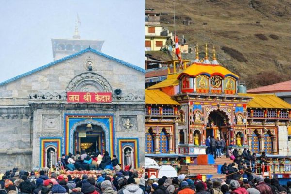
Do Dham Yatra Package from Haridwar - 6 Days / 5 Nights
- Quality4.6
- Location5
- Amenities4.6
- Services5
- Price4.4
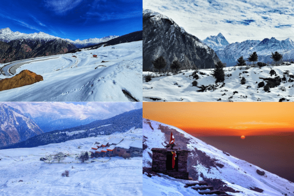
Auli Chopta Tour Package - 4 Night / 5 Days
- Quality4.6
- Location5
- Amenities4.6
- Services5
- Price4.4
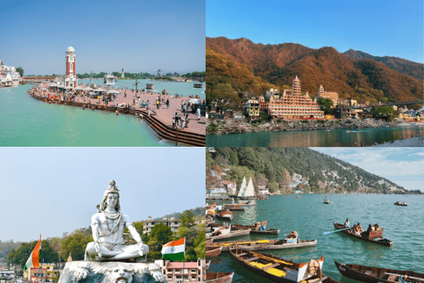
Haridwar Rishikesh Nainital Deluxe Package - 5 Nights / 6 Days
- Quality4.6
- Location5
- Amenities4.6
- Services5
- Price4.4

