Roopkund Trek
From
Duration
Tour Type
Overview
ROOPKUND-A Skelton Lake
Included / Exclude
Tour Itinerary
A scenic 10-hour journey (with breaks) awaits you as you travel to Lohajung, nestled 2300 meters high. The winding road cuts through Kumaon's valleys and lush coniferous forests, traversing the Shivalik ranges. While Gwaldam (Garhwal) lies on the direct route to Deval (your final stop), avoid it due to rain damage. Opt for the safer, longer path (36 km) through Tharali.
Deval, a well-stocked village, is your pitstop to replenish food and kerosene for the remainder of the trip. From there, brace yourself for the exciting, albeit challenging, final climb to Lohajung. The long, winding road steadily climbs, and the rumble of approaching vehicles adds to the thrill.
Prepare for cool, often cloudy weather with potential rain. Nighttime temperatures can plummet, so cozy hotels or lodges await you in Lohajung.
The trek kicks off with a hearty breakfast before setting off on a gentle jeep highway climb from Lohajung. After a leisurely 30-minute walk, you'll arrive at Kulling (6km), a peaceful village nestled within Garhwal's natural beauty. Take in the crisp air and spot exotic birds before turning right and descending towards a village.
An extended concrete path cuts through fields and homes, leading to the Neel Ganga stream. Cross the sturdy bridge and ascend the left ridge. The mildly screeching trail leads to Didna (2450m/8000ft), enveloped by majestic evergreen forests.
After a 2-hour climb, prepare to be awestruck by panoramic views. It's unexpected to find such vast open spaces amidst these high mountains. Didna shares similarities with Kulling, both attracting trekkers throughout the year: Didna during monsoons and summers, and Kulling in winter.
Wrap up the day's 10km trek by 3pm with a hot meal before settling into a quaint guesthouse for the night.
Today's trek ascends towards the enchanting Ali Bugyal (3400m/11,000ft), a high-altitude community nestled against Didna's backdrop. This mountain village boasts the title of one of India's highest settlements.
Choose your path: a moderate climb to the right or a steeper but shorter option to the left. Both lead to the same breathtaking summit. Along the way, marvel at the sight of Tolpani, temporary villages inhabited by local shepherds and their vast flocks. These welcoming folks often share their meals, creating a heartwarming experience.
The region boasts stunning, massive oak, birch, and rhododendron trees. Spring visitors are treated to a vibrant valley panorama adorned with countless rhododendron blossoms. As you reach higher ground, the treeline fades, revealing expansive grasslands.
A 3-4 hour climb leads you to the crown jewel - Ali Bugyal. This breathtaking meadow, reminiscent of a classic Windows XP wallpaper, is a feast for the eyes. During summers, wild cows and horses graze across these vibrant floral fields. On clear days, witness the majestic Himalayan peaks of Trishul and Mrigthuni towering in the distance. Trishul's imposing presence ignites a sense of adventure, beckoning you closer.
After traversing the meadows, a gentle incline leads to Bedni, your campsite for Day 3. Following lunch, visit the nearby Bedni Kund temple for awe-inspiring vistas of the Garhwal Himalayas (weather permitting).
Day 4 allows for a well-deserved later start, giving your legs a chance to recover. Today's destination is Ghora Lotani, a picturesque campsite nestled amidst breathtaking scenery.
The trail unfolds, revealing the dramatic panorama of the region. You'll encounter Patat Nacholi, a remote and untouched landmass, adding a touch of mystique to the journey.
Brace yourself for a demanding climb, ascending from 12,500ft to 14,500ft. The altitude, combined with the relentless trek, will test your endurance. Your legs may ache, and the thin atmosphere might cause some shortness of breath. However, the breathtaking beauty of the surroundings will fuel your determination. The positive energy emanating from the landscape will push you forward, leaving your worries behind.
After conquering roughly 10km, you'll reach Ghora Lotani, your haven for the night. While a good night's sleep is crucial, an early wake-up call awaits, for tomorrow promises an exhilarating adventure.
Rise early for the most challenging day of the trek. A hearty breakfast and thorough stretching are essential pre-requisites for the 10km uphill climb ahead.
Your destination is Bagubasa (14,000ft), a village housing the revered Kalyuvinayak temple. Reaching the temple requires an additional 2km, ascending roughly 200ft on a treacherous, zig-zagging path. Proper gear and clothing are crucial for navigating this uneven terrain. Take your time and walk with caution - a misstep could lead to serious injury.
But remember, no pain, no gain! The reward awaits you at the pinnacle. The reason behind building a temple in such a remote location remains a mystery. This centuries-old structure embodies traditional architecture and exudes a divine aura.
As the altitude increases, breathing becomes more labored due to the reduced oxygen level. Don't hesitate to take short breaks to manage any headaches or stomach pains that may arise.
Marvel at the temple's intricate stonework, a testament to the dedication of its creators. From the central location, a breathtaking vista unfolds before you: Roopkund, your final destination, shimmers in the distance, flanked by the majestic peaks of Trishul and Nandagunti.
Optional: For the truly adventurous, a rough trail leads to Bhaguabasa, 1km further. This high-altitude region (14,000ft) boasts unique flora that blooms only during the monsoon season. Brace yourself for a challenging terrain, however.
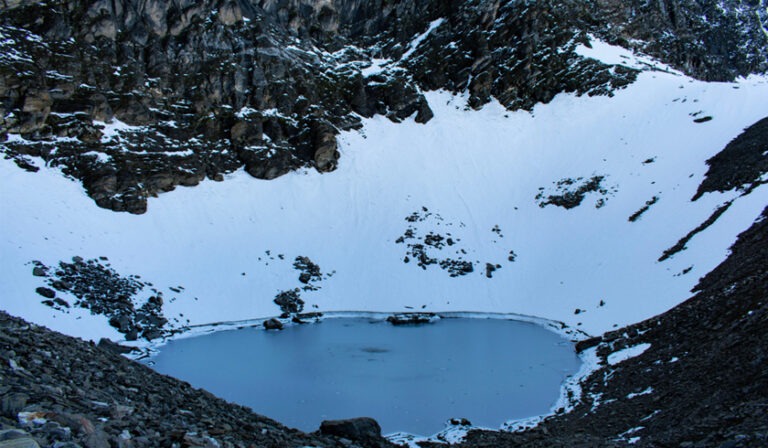
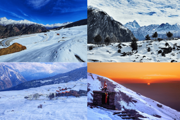
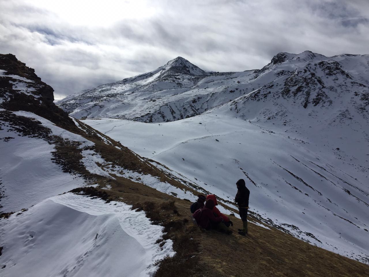
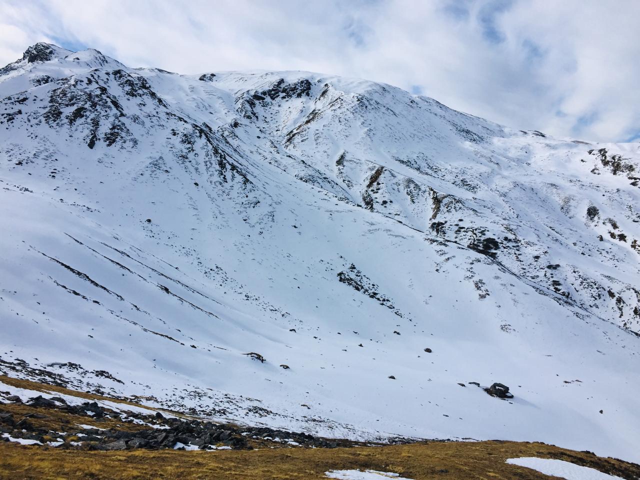
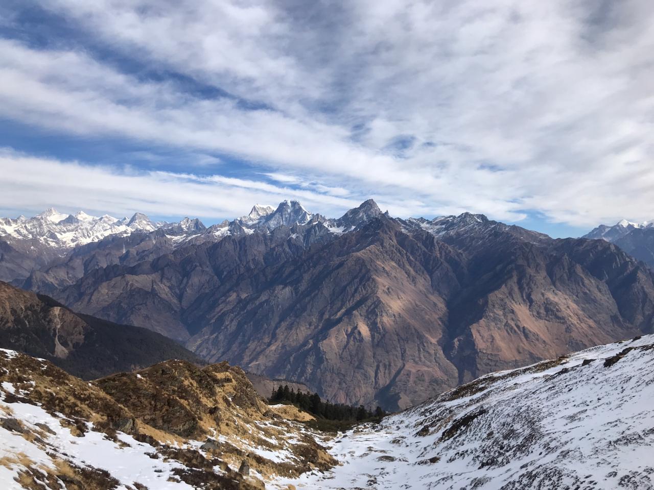
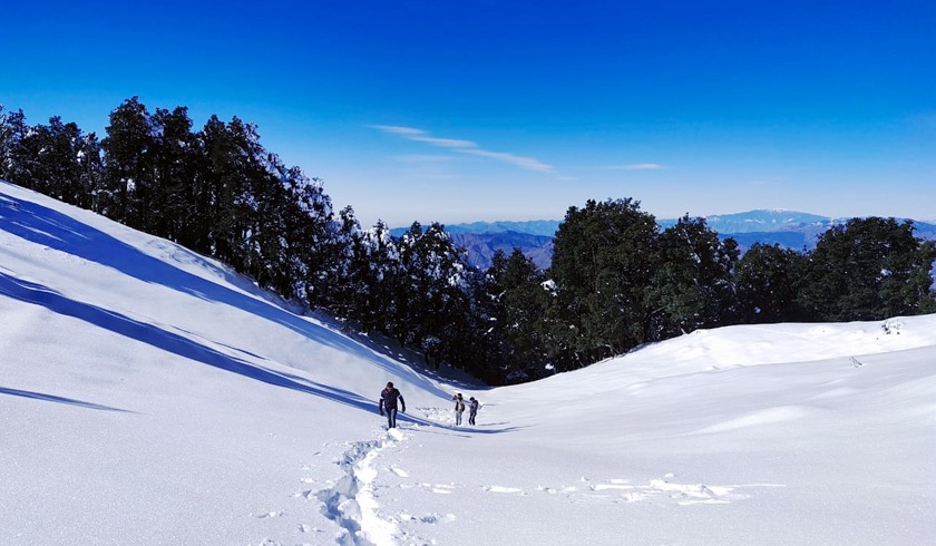
Rise and shine - today leads you to the crown jewel, Roopkund, perched at a staggering 16,000ft - the trek's highest point. While the path isn't technically challenging, the nearly 4-mile climb will test your endurance. Monsoon season may offer a clearer route with less snow cover.
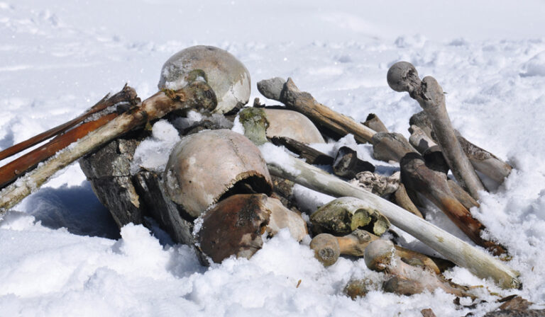
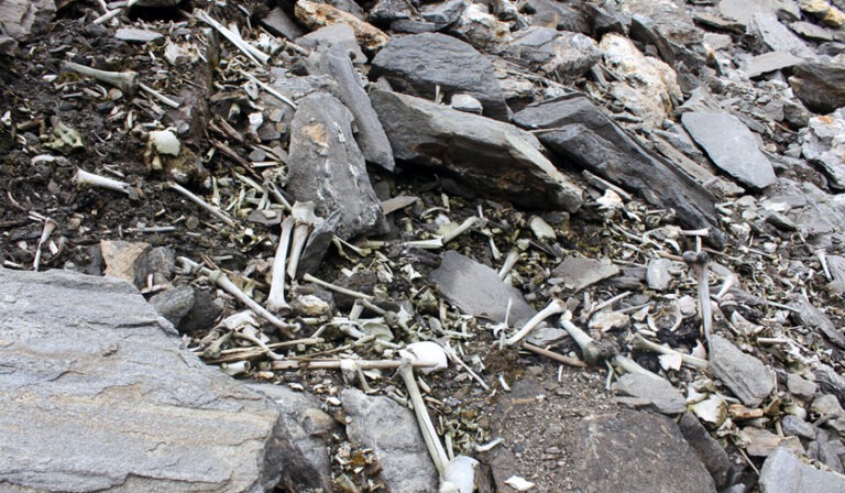
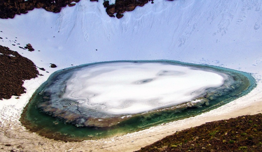
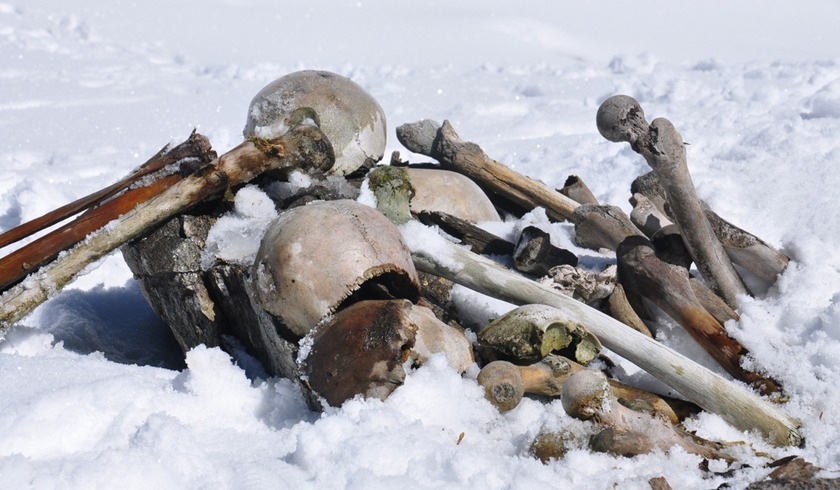
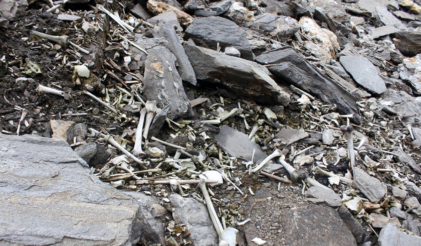
Leaving Bhaguabasa, your first stop is Chhirianag, aptly named for its snake-like ascent. From there, you reach the enigmatic Roopkund - the "Lake of Skeletons." This mysterious location continues to baffle archaeologists and scientists. Theories abound, with legends whispering of a king and his men caught in a deadly hailstorm during a pilgrimage to Nanda Devi. On a clear day, witness the awe-inspiring sight of roughly 300 human skulls scattered around the lake's edge.
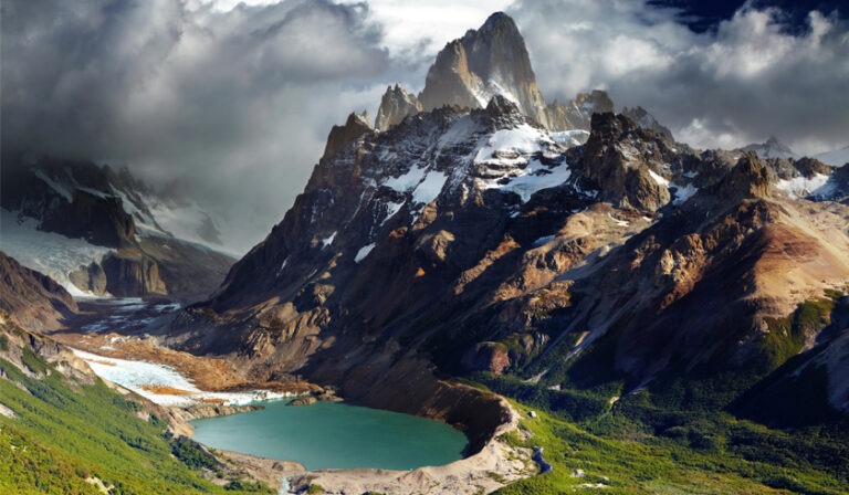
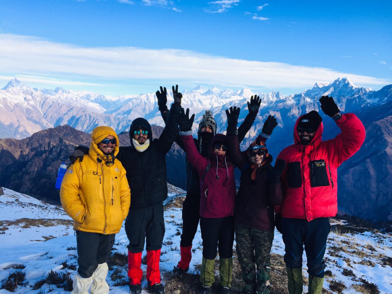
A challenging and steep trek follows, leading you to the Nanda Devi Temple, nestled within a Biosphere Reserve. This picturesque location is perfect for capturing memories with fellow trekkers.
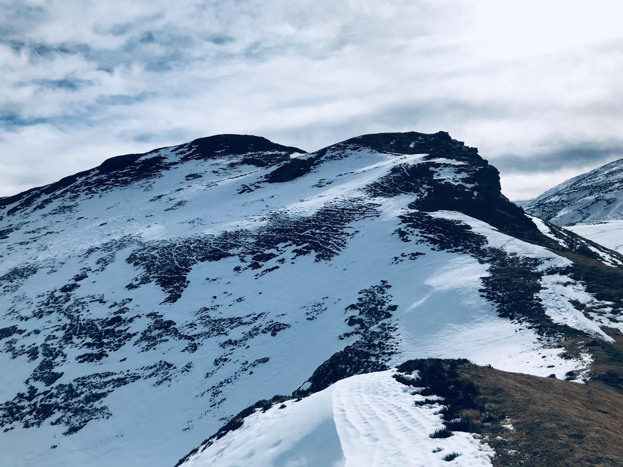
Weather permitting, some climbers may opt for the adrenaline-pumping Junargali Pass, soaring 16,700ft above sea level. This 45-minute climb requires good weather conditions. Be sure to pass through Bhagwabasa on your descent.
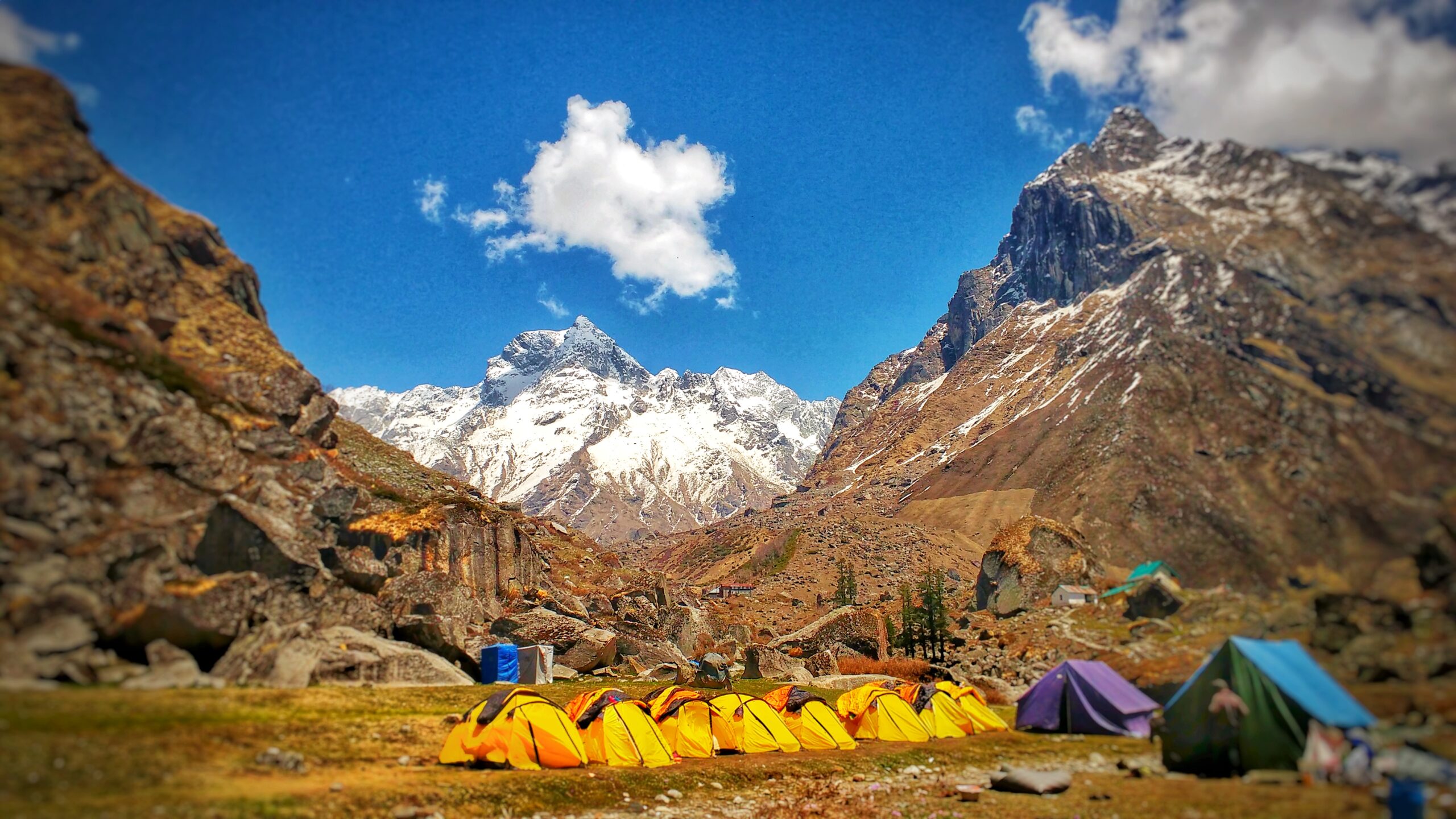
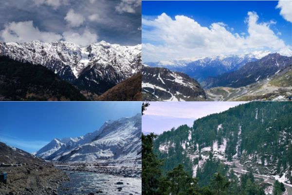
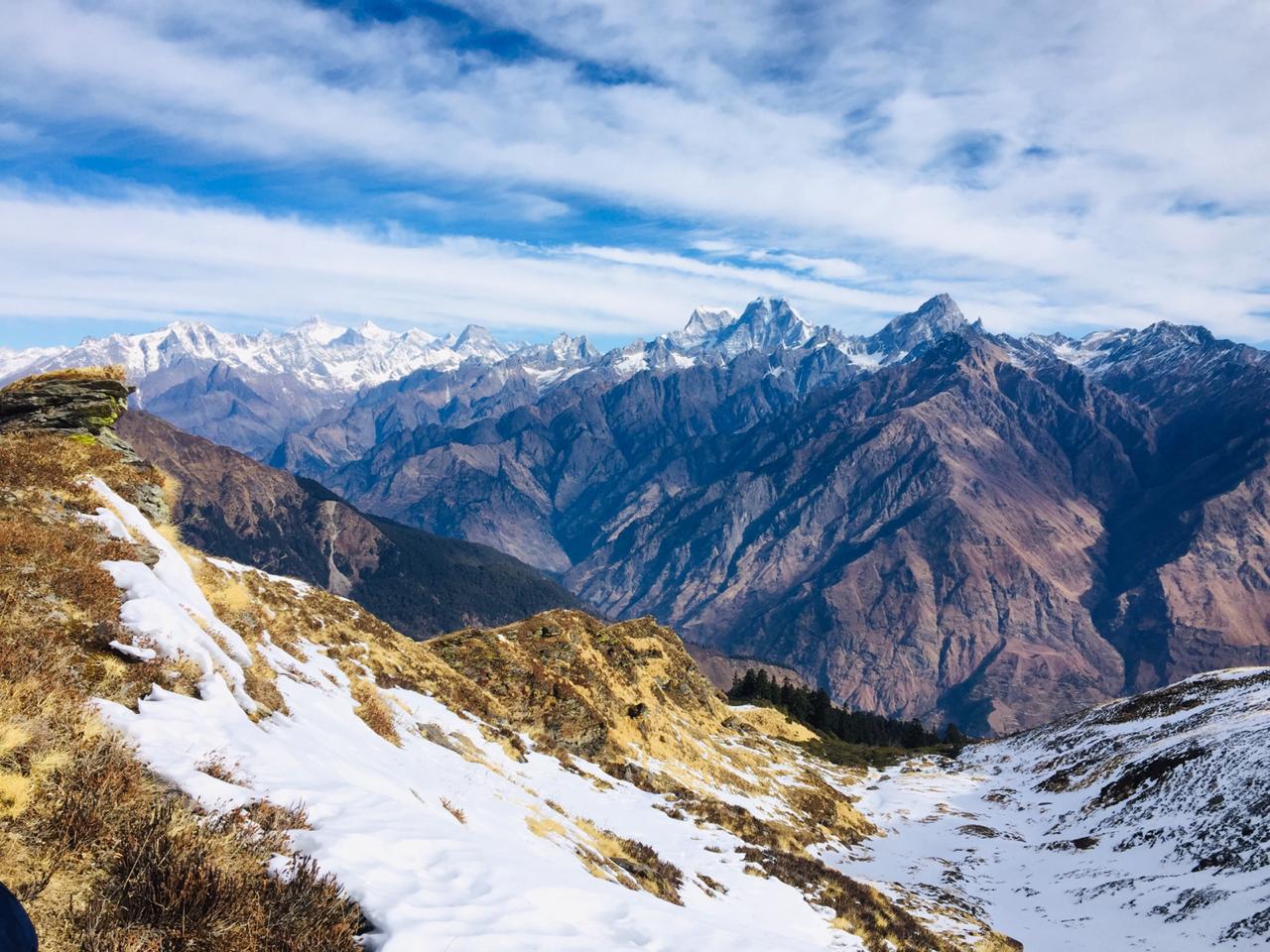
The downward journey is notoriously steeper than the climb, potentially causing some trepidation. You'll encounter Bhagwabasa, the "Tiger's Cave," and then ascend again to Patar Nachuni (12,500ft). Retracing your steps, you'll pass through Ghora Lotani and Bedni Bugyal before reaching your final camp amidst lush greenery.
This is the longest and most demanding day, stretching 15km and taking 10-15 hours to complete. Your legs will crave rest, but before slumber sets in, take a moment to acknowledge the incredible accomplishment this trek represents. It's a testament to your unwavering determination and perseverance.
Today marks the final descent back to Lohajung, your starting point. While the path remains the same, the experience is vastly different. Descending is easier on your body, and the right side of the trail seems less challenging compared to the strenuous climbs you conquered.
Wooden huts scattered along the path greet you for the first time. Soon, you'll encounter a fork in the road. Choose the right path, which descends gently. The surrounding forest comes alive with the melodious chirping of birds and the refreshing cool breeze. Remember to tread carefully on the uneven terrain; shortcuts are tempting but best avoided.
The journey unveils Gahroli Patal, a clearing within the dense forest. You'll then reach the banks of the Neel Ganga River. Following the riverbed, you'll arrive at the village of Wan, also known as Ran Ka Dhar. This charming village nestled amidst rolling hills offers breathtaking views to cherish forever.
After a few hundred meters, a waiting vehicle will transport you onwards. Today's journey covers approximately 18km and takes 10 hours. The final stretch from Wan to Lohajung takes about an hour on a bumpy road.
Back at the guesthouse, relive your incredible trek while enjoying the comfort of a soft mattress. These memories will remain with you forever, a testament to your adventurous spirit and physical strength.
Enjoy a leisurely morning with refreshing tea and a hearty breakfast, savoring the beauty of the hills one last time. Today, you bid farewell to the Himalayas and head back to Lohajung. Pack your belongings and depart by car for Kathgodam railway station - a roughly 10-hour journey. Keep some nausea medication handy for the winding roads.
Kathgodam offers trains to various destinations. Choose your return route and settle in for a comfortable journey, cherishing the unforgettable memories of your Roopkund trek. This adventure will forever be etched in your mind, a testament to your physical and mental resilience.
- What is the Roopkund Trek?
- The Roopkund Trek is a popular trekking route located in the Garhwal region of Uttarakhand, India. It is famous for its mysterious Roopkund Lake, also known as Skeleton Lake, which contains human skeletal remains dating back to the 9th century CE.
- How long is the Roopkund Trek?
- The Roopkund Trek typically takes around 7 to 9 days to complete, depending on the specific itinerary chosen by trekkers. The trek covers a distance of approximately 45 to 50 kilometers round trip.
- What is the best time to do the Roopkund Trek?
- The best time to undertake the Roopkund Trek is during the summer months of May to June and the post-monsoon season from September to October. During these months, the weather is generally favorable, and the trekking trails are accessible.
- Is the Roopkund Trek difficult?
- The Roopkund Trek is considered moderately challenging and is suitable for trekkers with some prior experience. The trail involves steep ascents, rocky terrain, and high-altitude conditions, requiring a good level of fitness and endurance.
- What is the altitude of Roopkund Lake?
- Roopkund Lake is situated at an altitude of approximately 5,029 meters (16,499 feet) above sea level. Trekkers ascend from lower altitudes in the Lohajung region to reach the lake, which requires proper acclimatization to prevent altitude-related illnesses.
- What permits are required for the Roopkund Trek?
- Trekkers may need to obtain permits from the local forest department or authorities before starting the Roopkund Trek. It's advisable to check the current permit requirements and regulations before planning the trek.
Related Tours
Review Scores
Customer Care : +91-7055613666